Jacksonville, Fla. — As Milton moves away from Florida, Action News Jax will provide live updates as we follow the storm, providing timely and critical information.
*Bookmark this link and refresh it often, as projections can change.
Follow Action News Jax Meteorologists on Twitter for updates:
Mike Buresh | Garrett Bedenbaugh | Corey Simma | Trevor Gibbs
LIVE UPDATES:
5:06 p.m. Thursday: Nassau County has lifted its evacuation order as of 5 p.m.
Action News Jax told you late Wednesday night when the following areas were asked to evacuate:
- Zone A: Egan’s Creek area, Crane Island (all areas), Long Point (all areas), 6th Street and Calhoun Street area, and River Crossing Way (north of Bonnieview Road)
- Zone D: Piney Island (all areas), Marsh Lakes (all areas), Holly Point (all areas), Brady Point (all areas), Oyster Bay area, and River Marsh Bend (all areas)
The county is going to continue conducting emergency operations and damage assessments throughout the County. Damage can be reported to the county at www.onenassau.com or by calling the Emergency Operations Center at 904-548-0900.
4:32 p.m. Thursday: At 5 p.m., St. Johns County is lifting the mandatory evacuation order for:
- All of Evacuation Zone A
- All of Evacuation Zone B
- The portion of Evacuation Zone F located south of State Road 206
County officials are still urging residents in flood-prone and low-lying areas to proceed with caution. Due to lingering floodwaters, some roads and locations within the community remain impassable.
Storm shelters in the county will close at 10 a.m. on Friday.
3:33 p.m. Thursday: Nassau County School District schools will reopen with normal operations on Friday.
2:11 p.m., Thursday: Clay County District Schools will reopen Friday, October 11th. Schools and district offices will resume normal operations.
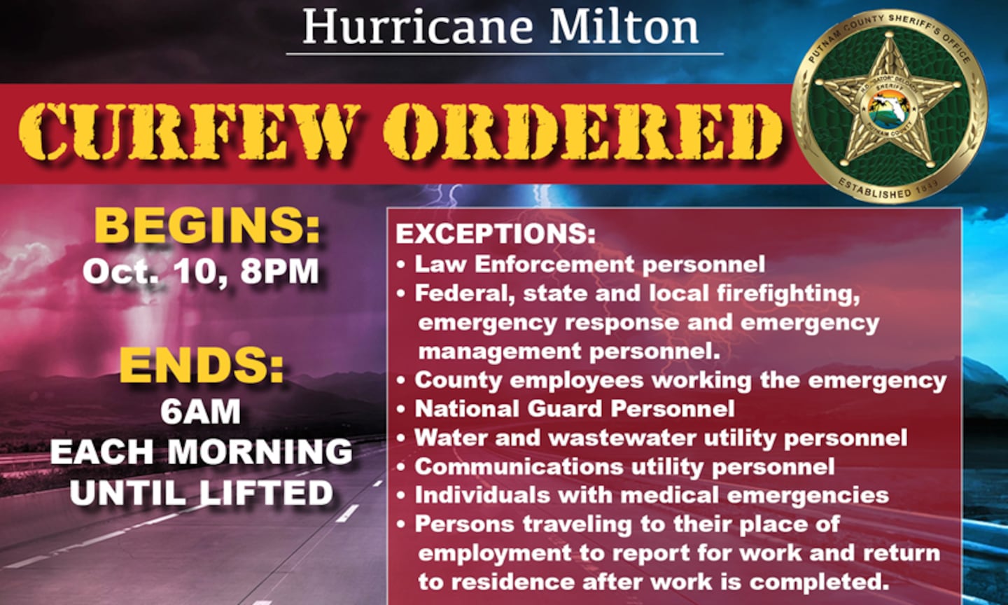
10:13 a.m., Thursday: Putnam County issues curfew. It goes in effect at 8 p.m. Thursday and will be lifted at 6 a.m. each morning.
9 a.m., Thursday: Gov. Ron DeSantis gave his first damage report and assessment as Milton moved off the state’s East Coast.
5:30 a.m. Thursday: Here’s a look around the state and the latest as Hurricane Milton moves off Florida’s East Coast.
5 a.m. Thursday: Action News Jax’s Logan McDonald is in St. Augustine this morning. Here’s his live shot showing how streets there are flooded (video below).
3:45 a.m. Thursday: A Flash Flood Warning is in effect for Putnam and St. Johns counties until 8:00 a.m.
3:06 a.m. Thursday: Milton remains a Category 1 hurricane. Winds have slowed down a bit to 85 mph.
2:09 a.m. Thursday: Downtown St. Augustine is starting to see flooding, the St. Johns County Sheriff’s Office said.
The impacts of Hurricane Milton are causing flooding in Downtown St. Augustine overnight. #HurricaneMilton pic.twitter.com/7bp8ibrchc
— St. Johns County Sheriff's Office (@TeamSJSO) October 10, 2024
1:32 a.m. Thursday: Hurricane Milton has been downgraded to a Category 1 storm with 90 mph winds and is moving east-northeast at 16 mph.
TRACKING THE TROPICS | The latest stats and track. More: https://t.co/W3ACmPc5wI. #FirstAlertWX pic.twitter.com/pXNY4ms3ek
— Garrett Bedenbaugh (@wxgarrett) October 10, 2024
12:38 a.m. Thursday: The St. Johns County Sheriff’s Office said Hurricane Milton is bringing flooding at East Deep Creek Blvd & Flagler Estates Blvd in St. Johns County.
Hurricane Milton flooding at East Deep Creek Blvd & Flagler Estates Blvd in St. Johns County.@SJCFireRescue #HurricaneMilton pic.twitter.com/DIkd3bfrgU
— St. Johns County Sheriff's Office (@TeamSJSO) October 10, 2024
>>> STREAM ACTION NEWS JAX LIVE <<<
[DOWNLOAD: Free Action News Jax app for alerts as news breaks]
[SIGN UP: Action News Jax Daily Headlines Newsletter]
Click here to download the free Action News Jax news and weather apps, click here to download the Action News Jax Now app for your smart TV and click here to stream Action News Jax live.


