
JACKSONVILLE, Fla. — First Alert Neighborhood Weather Network. Scan below &/or click * here *:

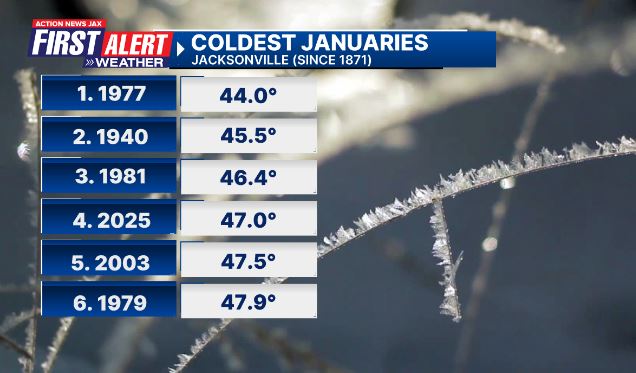
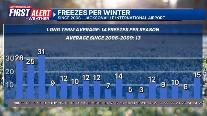
Our winter of discontent has hit a near all-time low as of Jan. 23rd - the 4th coldest January on record so far! And the winter as a whole has had the most freezes since three straight cold winters from 2008-2011.
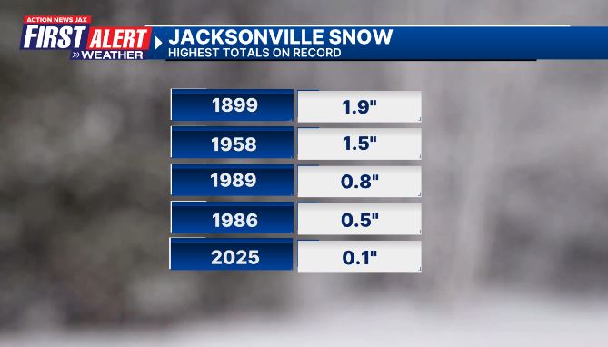
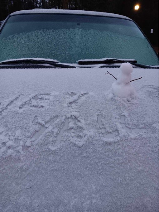
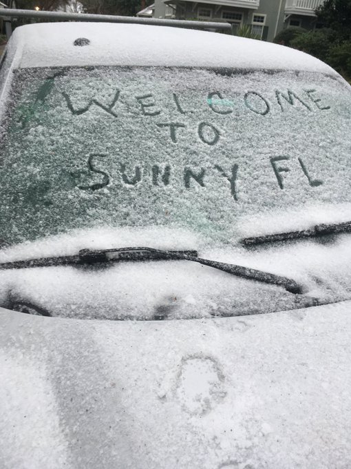
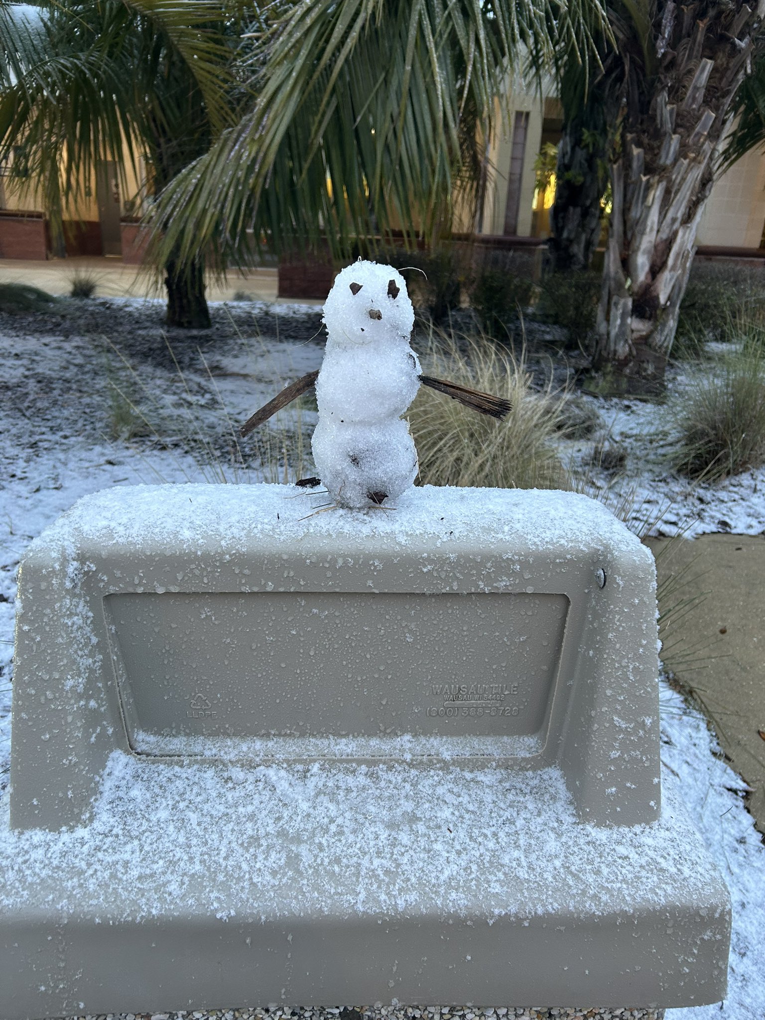
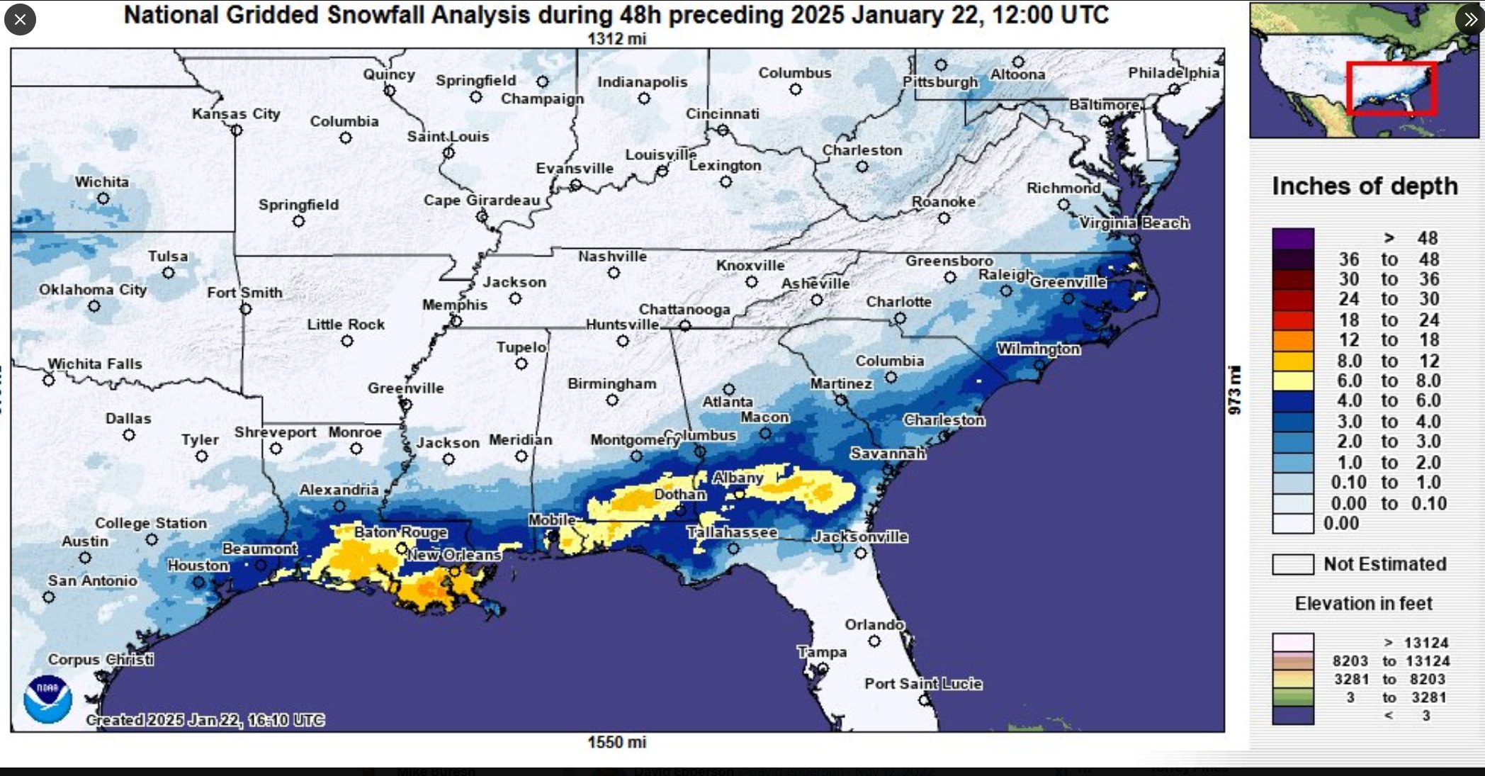
And the cold was accompanied by a winter storm in the Deep South that included parts of Northeast Florida & virtually all of Southeast Georgia. The 0.1″ of sleet at JIA made Jan. 22nd the 5th “snowiest” day on record in Jacksonville.

A disturbance moving from Mexico through the Northern Gulf & across Central Florida helped form a band of mixed wintry precip. (freezing rain/sleet/snow) to the north of the path of the disturbance. Cold temps. aloft - above a few thousand feet - resulted in fairly heavy sleet & freezing rain from Nassau Co. in Fl. & across virtually all of Southeast Ga.
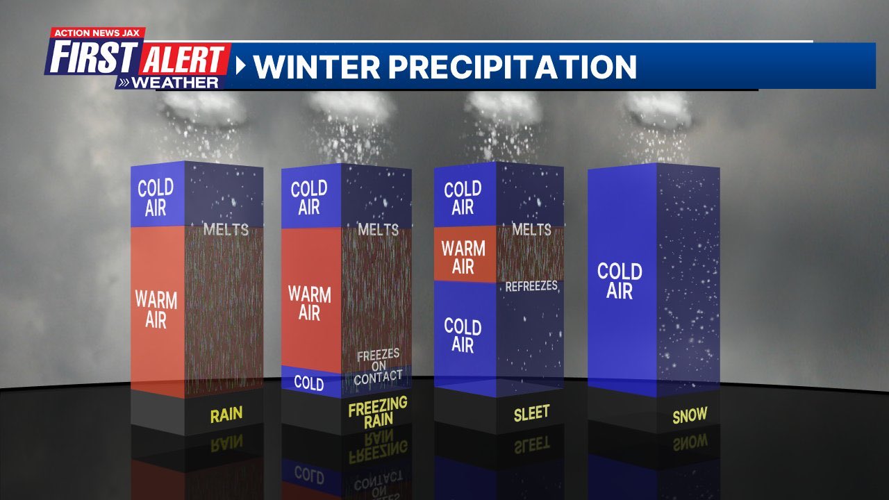
* Freezing rain: when temps. are above freezing through most of the atmosphere but at or below freezing at ground level causing rain drops to freeze upon contact with any surfaces at ground level.
* Sleet (ice pellets): Cold air aloft but sleet and/or snow melts due to a layer of warmer air only to re-freeze into ice pellets before reaching the ground because of colder temps.
* Snow: cold enough throughout the atmosphere so that there is no melting - all flakes to the ground!
Videographer Russ Pyne & I were stationed at the southbound rest stop/welcome center along I-95 in Northern Nassau Co. 3 miles south of the Fl./Ga. border:

#firstaletwx rest stop in Nassau County Florida 3 miles south of Fl/Ga border w/ videographer Russ Pyne @ActionNewsJax @WOKVNews pic.twitter.com/IrbQXmjJg5
— Mike Buresh (@MikeFirstAlert) January 22, 2025
#firstalertwx Nassau Co. Florida snow / Wed., 01/22 @ActionNewsJax @WOKVNews pic.twitter.com/9KuZmdMDYU
— Mike Buresh (@MikeFirstAlert) January 22, 2025
Nahunta, Georgia:

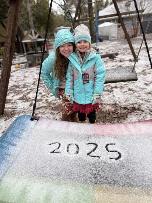
Yulee, Florida:
Oceanway (Northern Duval Co.):
Fernandina Beach, Fl.:
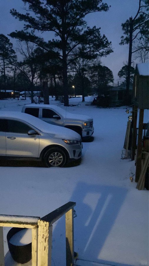
Waycross, Ga.:
Nassau Co. welcome center, I-95:
More than a foot(!) of snow fell in the vicinity of New Orleans... & in some cases more snow has fallen this winter in New Orleans vs. northern latitudes including Anchorage, Alaska! If the 10 inches of snow in Milton, Fl. - Western Panhandle - is confirmed, it will go down as the heaviest single storm snowfall total in Florida history.
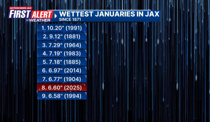
In addition to the cold, Jacksonville has been wet! This month is the 8th wettest January on record in Jacksonville:
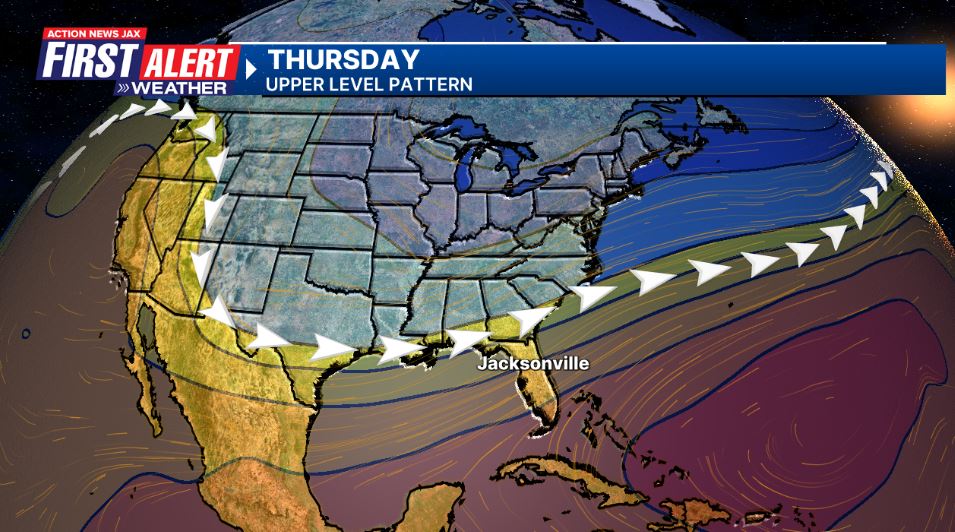
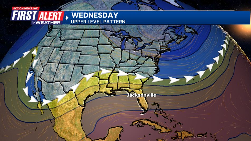
One of the culprits for our cold, wet & active January has been a persistent dip in the jet stream that’s been centered over the middle & Eastern U.S. This jet orientation has also resulted in a dry Western U.S. (California wildfires). But there are changes afoot! The jet stream looks to realign itself by the end of January into at least early Feb. with the dip (trough of low pressure) shifting more to the west. The result will be warmer temps. for Jacksonville/NE Fl. & SE Ga. & better chances for some much needed rain for Southern California. The first image below is the jet stream the week of Jan. 20th vs. the forecast jet stream for late January:
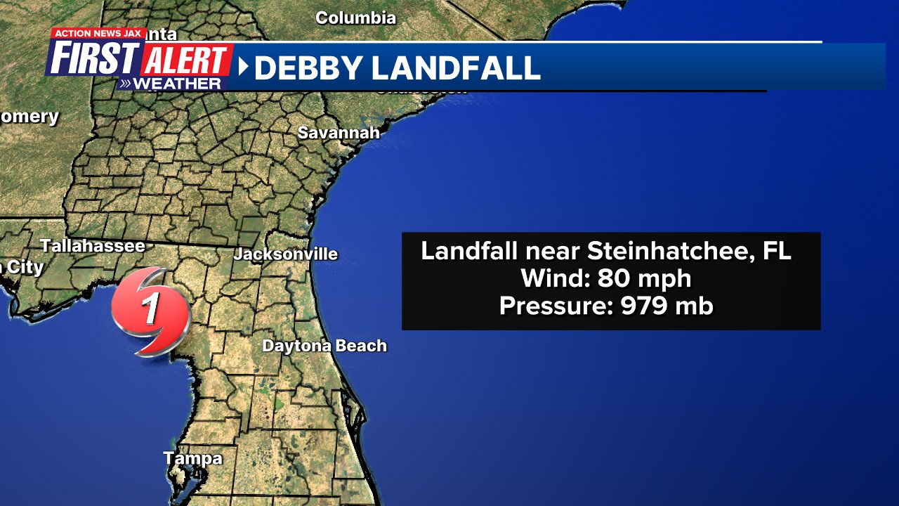
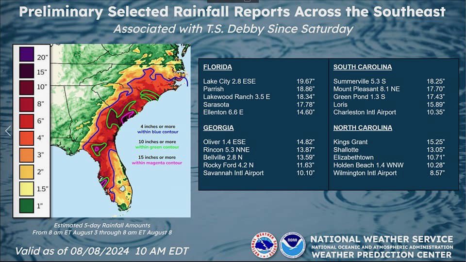
The National Hurricane Center issued their hurricane “Debby” report - * here *. My own “Debby Details & Analysis” * here *. Debby caused 18 fatalities, 11 directly from the storm and about $2.5 billion in damage (USD). The Cat. 1 landfall was early Monday, Aug. 5th on the Big Bend of Florida. Nearly 6″ of rain fell at JIA in Northern Duval Co. with nearly 20″ of rain near Lake City in Columbia Co. Debby was the first of 3 hurricanes to hit Florida in ‘24 (in addition to “Helene” & “Milton”.


 Sign Up


