JACKSONVILLE, Fla. — First Alert Neighborhood Weather Network. Scan below &/or click * here *:
A surge of tropical moisture combined with a stalled front to produce very heavy thunderstorms Tue. & Wed. after a brief respite from a wet August making for a nice albeit hot Labor Day weekend. Did you notice how loud the thunder was?? The most likely culprit was a temperature inversion that essentially created a cap on the atmosphere with warmer air aloft vs. cooler air near ground level. After a lightning strike, the clap of thunder encounters the inversion & is bounced back (deflected) by the inversion to the ground. Remember: “when thunder roars, go indoors” (& cover your ears!).
Tim Robinson, Jacksonville Beach:
So we’re more than half way through the ‘24 Atlantic hurricane season & fast approaching the peak of the hurricane season (Sept. 10th) & after many “over the top” forecasts for the hurricane season, it hasn’t delivered (thankfully!) so far. It’s pretty clear the very high numbers are not likely to be reached, but we still have a long ways to go & more than 60% of named storms in a typical Atlantic hurricane season occur in Sept. & Oct. So what gives?? Well - I’m convinced one of the primary culprits has been an unfavorable MJO (Madden-Julian Oscillation). Perhaps another culprit is the widespread nature of the planet’s ocean temps. Yup - the water may be too warm(!). And then there are the “easy” answers like Saharan dust (not substantial after July this year) & wind shear (generally not prohibitive recently) & dry mid & upper level air. In any case... it just goes to show you, warm oceans are not the only necessary ingredient for an active hurricane season. In many - most, in fact - hurricane seasons, the meteorology has to be right too.
Check out “Talking the Tropics With Mike” - updated every day during the Atlantic hurricane season. It only takes one storm in the wrong place at the wrong time to make for a memorable season - always be prepared.
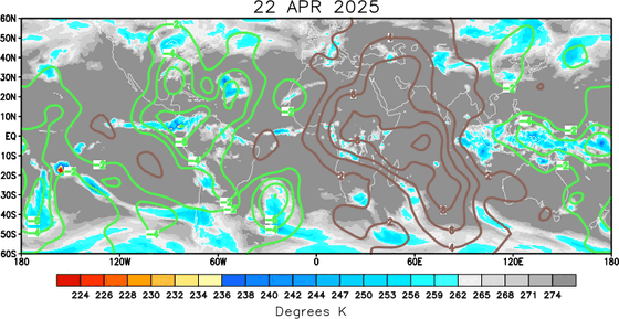
‘Velocity potential anomalies’ below shows massive “sinking” air (brown lines) & overall hostile conditions for tropical development continue across the Atlantic Basin. In such a state, tropical development can occur but overall conditions are not as conducive as when there is overall rising (green lines) air such as much of the Pacific Basin where convection is active. This “pulse” of upward motion should move over the Atlantic Basin mid to late September.

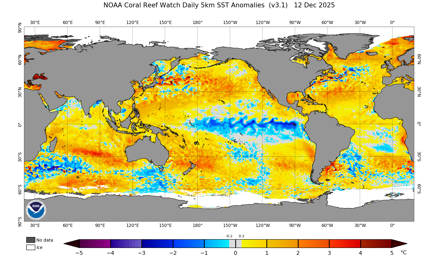
A lot of warm ocean water over the Northern Hemisphere. Note developing La Nina near the equatorial Pacific:

ACE - accumulated cyclone energy has fallen well behind “average” after a fast start. Table & graph below courtesy Phil Klotzbach:
Meteorological summer is in the books. For June/July/August in Jacksonville, temps. were well above avg. - the 2nd hottest on record since 1971 (JIA) but also turned very wet after a dry June (Aug. was the 6th wettest on record):
So you might be looking forward to autumn & its fall color. Maps below provided by The Foliage Report shows the average timing of peak color in the coming months. The second map shows where we’re just starting to see hints of fall near the U.S./Canadian border as well as some drought driven color centered on Tennessee.


